📅 Visited: December 2025
The moment I reached the observation deck and the view opened up, something came out of my mouth that wasn’t a word.
Below me, inlets. Everywhere.
Not one or two.
Narrow arms of water and rounded humps of land, folded into each other so densely that I genuinely couldn’t tell where the land stopped and the sea started.
The winter sky was clear, and the surface of the bay was throwing back light.
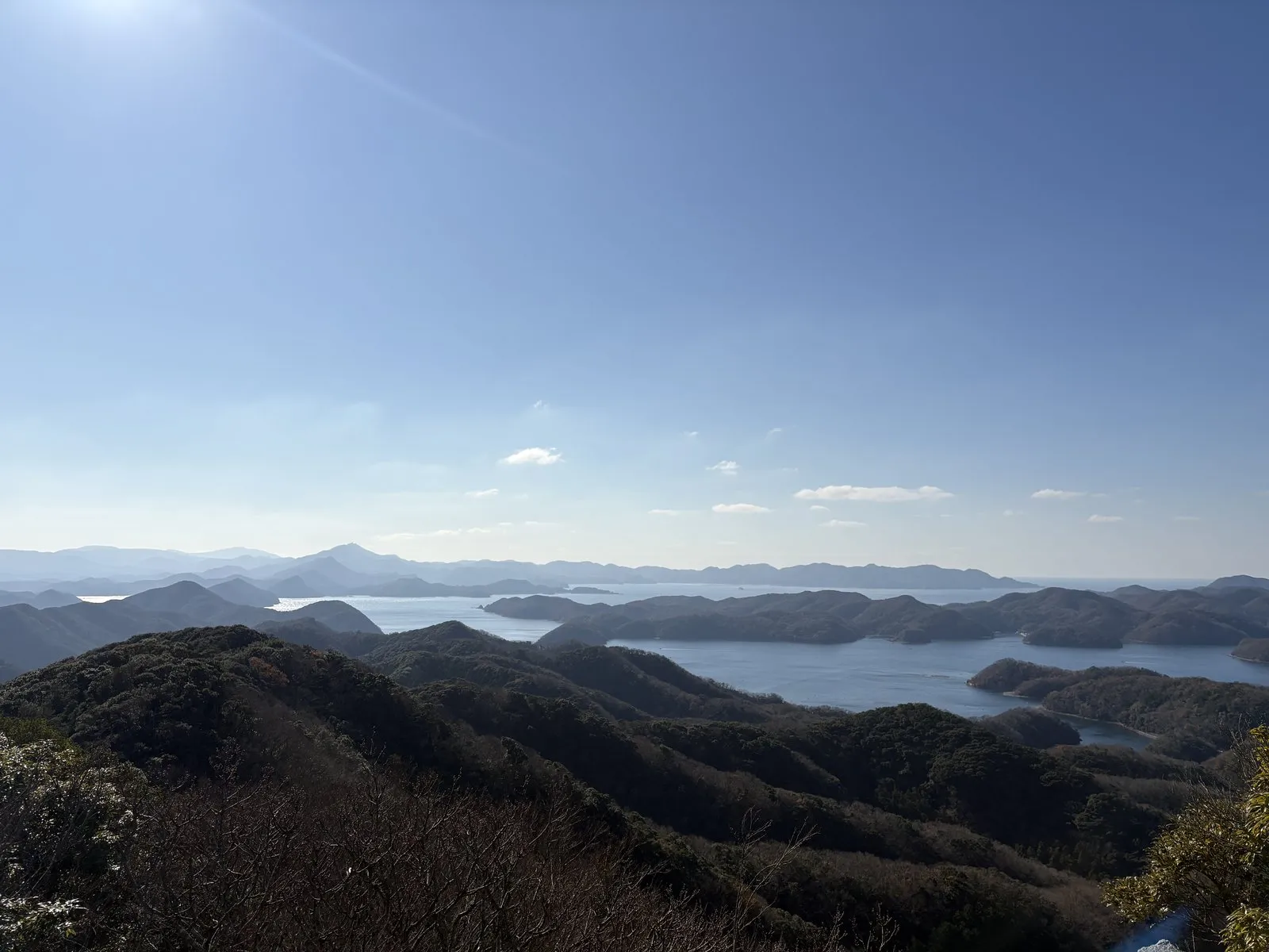
This is Eboshidake Observatory, looking down over Asaji Bay on the island of Tsushima.
And there was one other thing on this trip that kept stopping me in my tracks — something on a completely different scale.
The rock at my feet.
Along the shore, cliff faces with dozens of fine layers stacked one on top of another.
Touch them and pieces come away in your hand.
Zoom out and you get a shredded, tangled coastline. Zoom in and you get layers, one sheet at a time.
Tsushima turned out to be an island that keeps making you switch between those two scales.
This was originally hilly country cut through by valleys. Seawater is thought to have moved in, turning what had been valleys into long, narrow inlets.
That's why the heads of the inlets are so thin, and why what used to be ridges remain on either side as peninsulas and islands. Seen from above, land and sea look like interlocked fingers — and that, it is said, is the reason.
Put another way, the shape of the inlets in front of me is the shape of the valleys as they were before the sea arrived. An old landscape of hills and hollows, still there, just hidden under the waterline.
Once I had that in my head, the countless inlets started to look like a map of drowned valleys.
| Location | Tsushima City, Nagasaki (on high ground above Asaji Bay) |
| Don't miss | The full panorama of Asaji Bay's ria coastline |
| Note | Even in winter, a clear day gives you a bright, wide-open view |
First, where Tsushima actually sits
Let me back up to the morning we landed.
We flew to Fukuoka, then connected onward to Tsushima.
The connection time was twenty minutes.
I’ll be honest: I did not think we were going to make it.
But a member of staff was waiting for us in the arrivals hall and walked us straight to the transfer counter.
Thanks to that, we made the Tsushima flight with room to spare.
It was a propeller plane — a small aircraft crossing open water, coming down at Tsushima Airport.
We picked up a rental car at the airport and set off.
Out of the car window, mountains and sea took turns.
The road would climb into the hills, and then, one curve later, the sea would suddenly open up.
And at the innermost point of every bay, without fail, a village.
That rhythm kept up the entire time we were on the island.
The neighbouring country is closer than mainland Kyushu. That position is why the island is called Japan's "border island."
Most of the island is said to consist of alternating beds of sandstone and mudstone — sand and mud that settled on a sea floor, one on top of the other, over and over.
The striped effect of sand layers and mud layers is thought to be the record of sediment repeatedly pouring onto the sea floor. Coarse sand sinks first, fine mud settles slowly afterwards. Repeat that many times and it is said you get stripes.
In other words, Tsushima is an island built out of what used to be the bottom of the sea. Every rock that stopped me on this trip was part of that record.
So this isn’t just a place that happens to be near another country.
That was the feeling I had, driving.
Anagotei — golden conger you can’t eat anywhere else
The first stop after landing was a restaurant called Anagotei.
They serve Tsushima’s ogon anago, or “golden conger.”
The dining room is wide and bright, with a lot of light coming through the windows.
I ordered the deluxe seiro set, medium size, at ¥3,800.
It comes with an appetiser, chawanmushi, clear soup, pickles, dessert, and coffee.
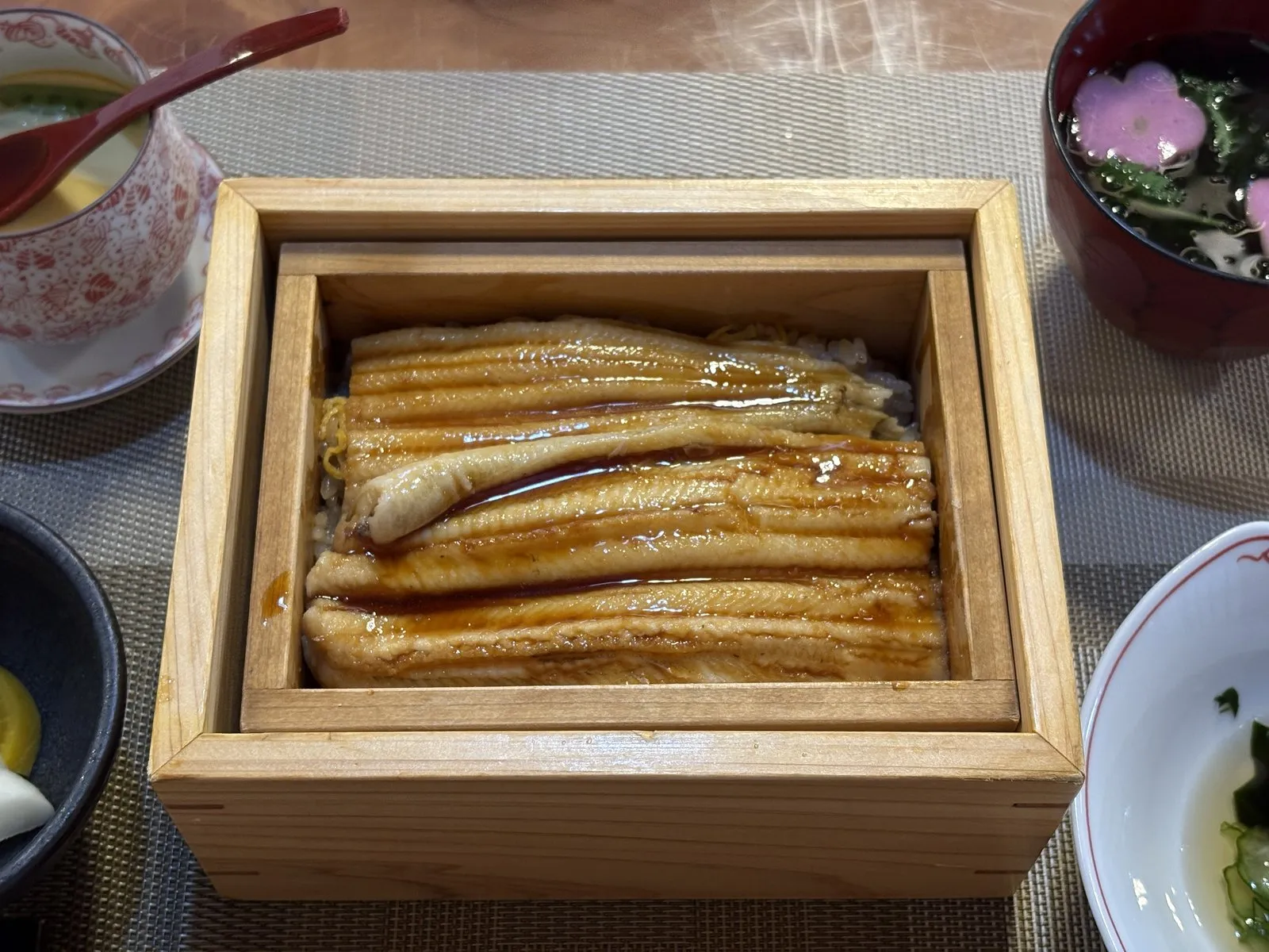
The appetiser was already a good sign.
Burdock root wrapped in conger, plus a conger omelette.
The omelette was like umaki — soft, and lightly sweet in the way simmered conger is.
Then the main event, the seiro.
Far gentler than I’d expected.
I associate conger with a sweet-savoury glaze, but here the flavour of the fish itself comes forward.
We also ordered the shirayaki, plain-grilled conger, at ¥2,200.
It arrived big.
And so airy that it fell apart in the mouth like a white-fleshed fish.
Then conger sashimi, also ¥2,200.
Delicate, but with real fat and depth behind it.
The skin has an odd, springy bite that I enjoyed.
The soy sauce served alongside was on the sweet side, and slightly syrupy.
Dessert was a custard pudding made by the head chef himself, with blueberries — soft and rich.
The nicest touch: we’d only ordered one set, and they brought out the appetiser and the dessert for two.
| Location | Tsushima City, Nagasaki |
| Specialty | Golden conger. Deluxe seiro set, medium ¥3,800; plain-grilled ¥2,200; sashimi ¥2,200 |
| Note | Spacious, bright room. The deluxe seiro includes appetiser, chawanmushi and dessert |
Fed, we drove up to Eboshidake Observatory — the view this article opened with.
And after coming down from the observatory, we stopped at a confectioner called Kasho Momonoya.
They specialise in kasumaki, and what I had was an end-piece kasumaki for ¥100.
The bean paste wasn’t overly sweet — a gentle, easygoing thing.
Better still, you can try both the black and the white versions.
Unatsura no Tateiwa — rock that peels, and crumbles when you touch it
This might be the place from the trip I’ll remember longest.
Unatsura no Tateiwa, the standing rock at Unatsura.
You park in the fishing port car park and walk from there.
The tide was high that day, so we could only get as far as the rocks in front of the Tateiwa itself.
That was more than enough.
Because the rock is extraordinary.
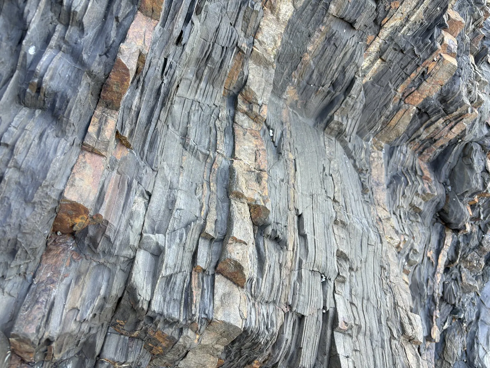
Dozens of thin grey and brown layers, stacked one on the next.
And each individual layer stands out in three dimensions.
Like the pages of a book, right on the verge of turning.
I touched one gently, and it crumbled away.
I had never seen strata this close up before.
Standing in front of a rock with no idea what you’re looking at, saying that back and forth — honestly, that’s the fun of it.
Look closer and there are glittering white lines running between the layers.
Where the waves hit, the layers have had their edges taken off and gone smooth.
From a distance it had looked like nothing more than a big lump of rock.
Only up close do the individual sheets come into focus.
That switch in scale was the thing I couldn’t get enough of.
Sand layers and mud layers differ in grain size and in how they harden. A mud layer is built of fine grains laid down in thin sheets, so it is thought to split readily along those surfaces.
Apply a bit of force and it flakes apart at the boundaries between layers, which is what gives you the book-page look.
The reason it crumbled at a touch is said to be that, sitting right at the water's edge, the surface has been worn fragile by spray, wind and rain.
The same explanation covers why only the wave-struck sections are smooth. The hard sand layers survive; the soft mud layers get stripped away first. That difference in how fast each layer erodes is thought to be exactly what you're seeing in the texture of the rock face.
There was something worth looking at underfoot, too.
The whole beach is paved with flat, rounded stones.
Every one of them worn smooth, corners gone.
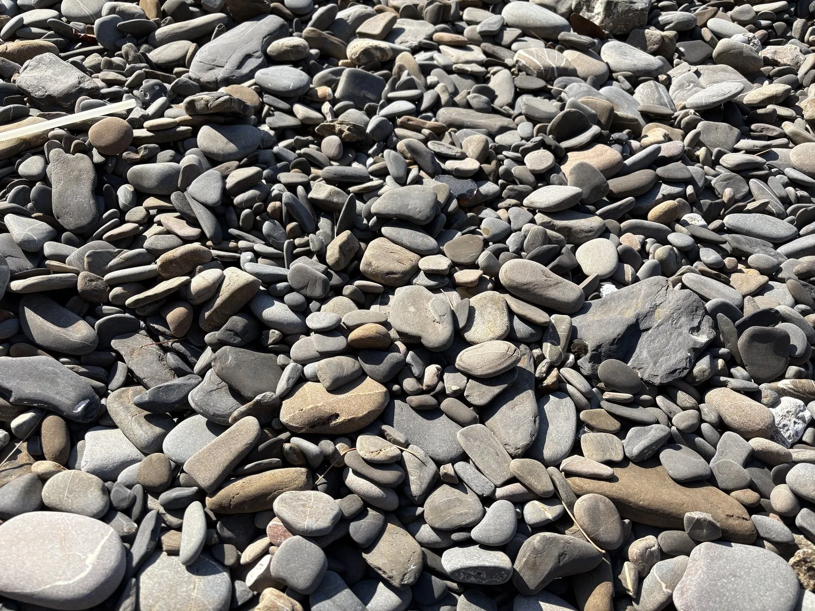
These must originally be fragments of layers that fell off that cliff.
Tumbled by the waves, they lost their edges and ended up here as flat stones.
That was the moment the cliff and the beach became one continuous story.
There was nobody else around.
A weekday in winter, only the sound of the waves, the two of us looking at rocks.
A luxurious stretch of time.
| Location | Tsushima City, Nagasaki (near Unatsura fishing port) |
| Parking | Park at the fishing port and walk from there |
| Don't miss | Sandstone and mudstone beds at arm's length; the flat rounded pebbles on the beach |
| Watch out for | At high tide you can't reach the Tateiwa. The rock is fragile and the footing slippery |
The “foreign country” lookout — was that a ship, or a building?
We drove almost to the northern tip of the island, to the observatory whose name translates as “the lookout where you can see a foreign country.”
As advertised, it’s a place where, in the right conditions, South Korea is said to be visible.
I’ll get straight to it.
We couldn’t see it.
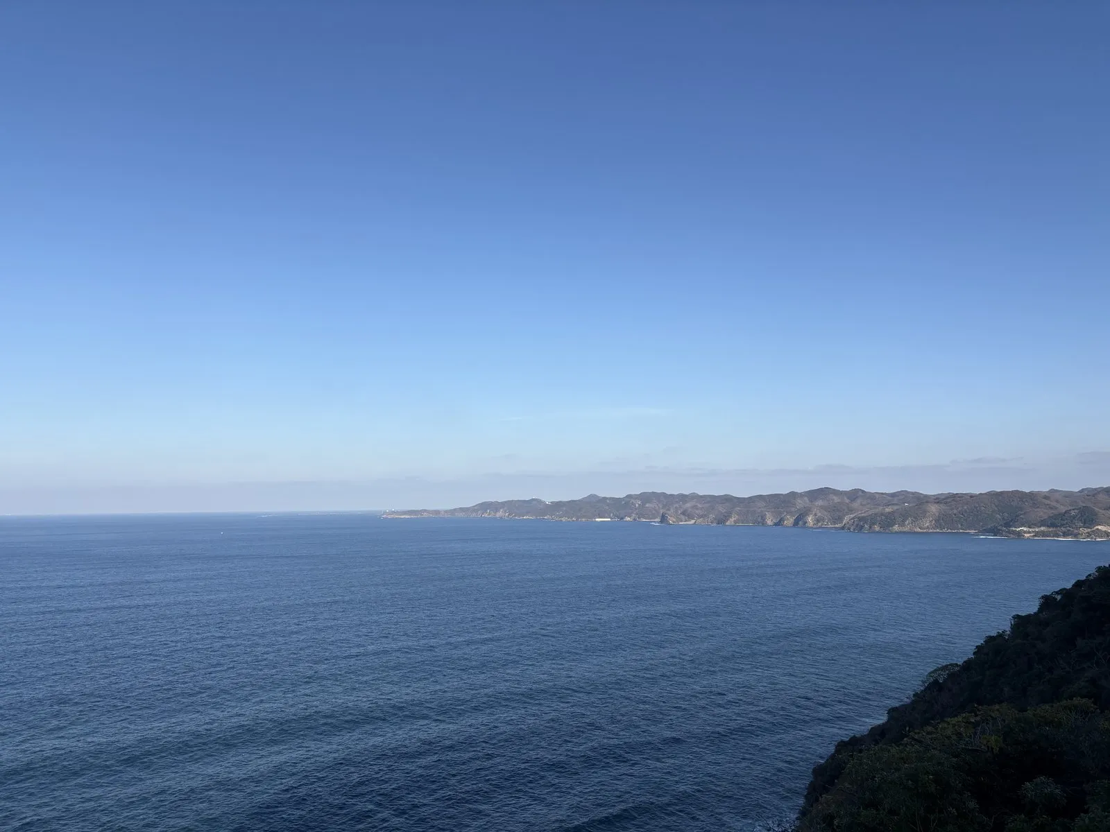
The water in front was deep blue, with the ridgeline of northern Tsushima lying across the middle distance.
Beyond that, the horizon was a white haze.
There’s a mounted pair of binoculars, so I looked through.
And there was something.
But I couldn’t tell whether it was a ship or a building in South Korea.
Behind what looked like a vessel, there seemed to be a thin, tower-like shape standing up.
In the end we never worked out what it was.
Going home without an answer wasn’t such a bad outcome, as it turns out.
It was a bitterly cold spot.
Although — remarkably, for somewhere this remote — there are toilets, with running water.
The fact that the island looks after its far edges impressed me a little.
| Location | Tsushima City, Nagasaki (northern part of the island) |
| Parking | Car park at the lookout, with toilets |
| Don't miss | The view across the Tsushima Strait; mounted binoculars on site |
| Watch out for | Windy and cold in winter. Whether you see the far shore is down to the weather |
We also stopped at a second one, the Korea Observatory.
Nothing visible from there either.
What we got instead was a rather charming building, which I ended up photographing anyway.
That night we stayed at the Toyoko Inn in Hitakatsu.
Dinner included a free curry — at the northern end of the island, that is not nothing.
Morning at Tonosaki — not a splash, a detonation
Day two started with a walk.
The Tonosaki course of the Kitataki Road, in Tonosaki Quasi-National Park.
I looked up and there were black kites everywhere.
Several of them, circling slowly, drawing rings in the sky.
The further along the path you go, the narrower it gets.
And then I noticed something.
Waves. On both sides.
Which, given that you’re walking out toward the tip of a headland, is obvious in retrospect.
But the sound wasn’t what I’d imagined.
Not a whoosh.
A boom.
Waves hitting rock hard enough that you feel it in your chest.
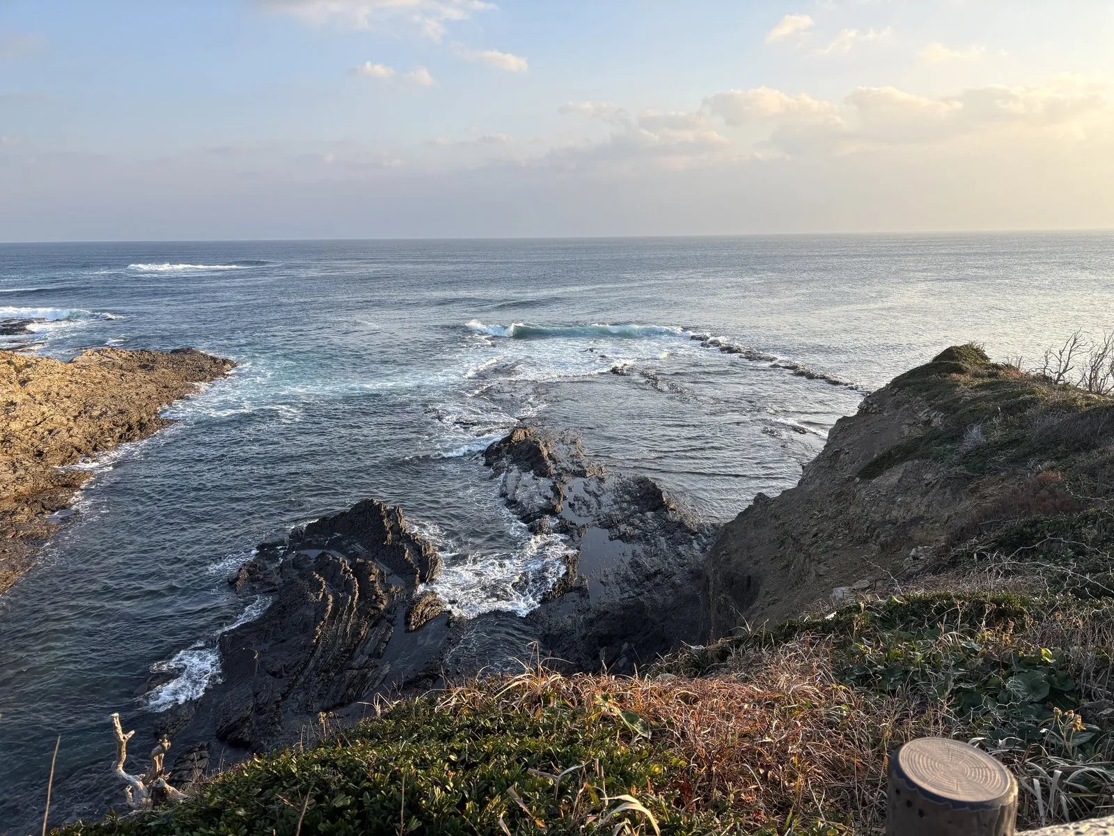
The morning sun was bouncing off the water, laying down a road of light.
In the gaps between waves, birdsong.
I had no idea a morning walk could be this good.
| Location | Tsushima City, Nagasaki (a headland in the north of the island) |
| Parking | Car park at the trailhead |
| Don't miss | Waves detonating on the reef, morning light on the water, kites and birdsong |
| Watch out for | The path narrows the further you go. Wear proper shoes |
The ripple marks at Ajiro — a tiled pattern that used to be ripples on water
After the morning walk we headed south.
The target was the ripple marks at Ajiro.
We climbed down to the water’s edge, and I said something out loud again.
“Look at this. Look at this!”
Across the flat rock surface in front of us, a dense honeycomb pattern.
It looks like someone laid tiles.
And back to the left, a rock wall lined with fine layers.
Two completely different faces of rock, sitting side by side in the same spot.
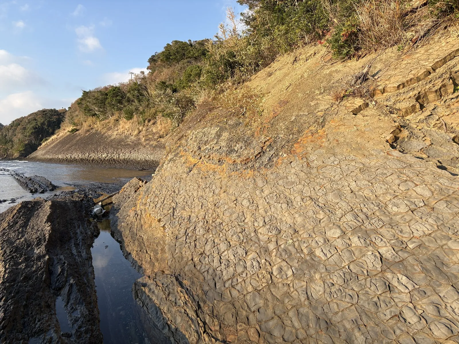
Here too, the rock looked ready to peel.
Or rather — it does peel.
Beneath one large rock, black fragments were scattered around.
At a glance, just stones.
Look properly and they’d clearly come off the rock above.
The water is beautiful.
In the shallows you can see straight to the bottom, the pattern in the rock wavering under the surface.
So what is that tiled pattern?
Some kind of trace of waves, we guessed, standing there.
When water moves back and forth over a sandy bottom, it creates fine wave-shaped ridges on the surface. If the next load of sediment settles on top and caps them, the ridges are thought to survive without being flattened.
In time the sand hardens into rock, and the pattern is locked in with it. What's in front of you is the movement of water on one particular day, a very long time ago, turned to stone.
The other puzzle is why a pattern made on a sea floor is now on the surface where you can walk on it. After the beds hardened, crustal movement is thought to have lifted and tilted them until they emerged at the surface.
That's why the same site has both a flat pavement and a wall where the layers stand up on end. Only the direction they were moved differs — they are said to be the same sea-floor beds underneath.
The same day we also stopped at the stone pagoda at Goneo.
The road partway there was closed for construction, so we had to take a long detour.
When we finally arrived, there was rock here with the same tile-like look as at Ajiro.
It reads like fossilised waves here too.
Meeting the same pattern in different corners of the island was half the pleasure.
| Location | Tsushima City, Nagasaki |
| Parking | Parking space nearby |
| Don't miss | The honeycombed flat rock pavement, and the layered wall beside it |
| Watch out for | Rocky shoreline. Wet surfaces are slippery and the rock flakes off easily |
On the way we also called in at the ginkgo tree at Kin.
The leaves were long gone, but the trunk is enormous.
We were told it was struck by lightning years ago and is hollow inside.
And still, the tree is alive.
Standing there hollowed out — I think that’s the closest I’ve come to seeing what people mean by vitality.
Nishinokoide and Kofunakoshi — mille-feuille rock, and boats on a mirror
Next stop was Nishinokoide.
It’s in a place called Kofunakoshi.
I’d seen it on the TV programme Bura Tamori and had wanted to come ever since.
The first thing to grab me was, again, the rock.
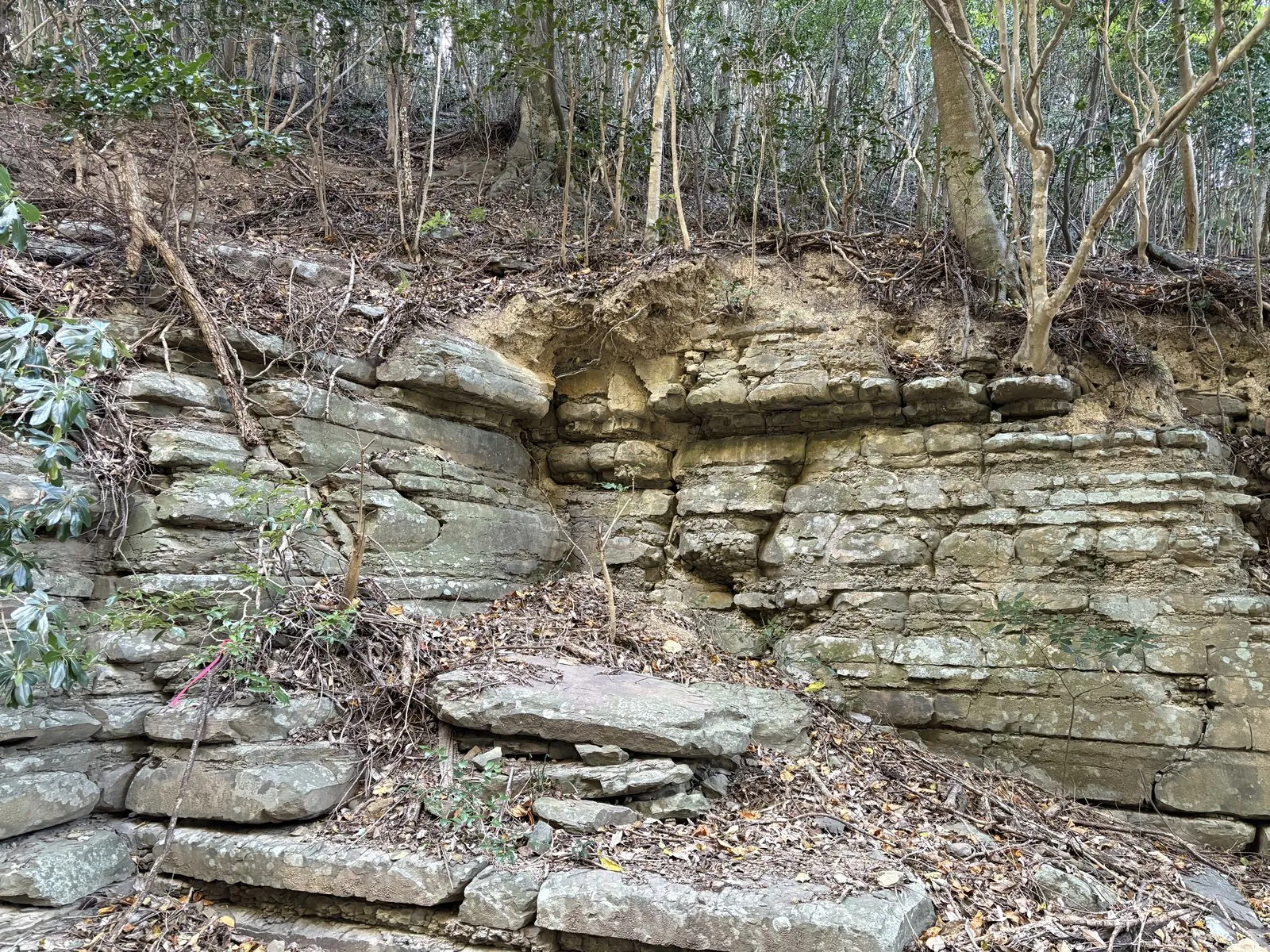
Horizontal layers, stacked with real neatness.
“Mille-feuille” arrived in my head unprompted.
At Unatsura the layers had been peeling up in three dimensions; here they lie in tidy horizontal ranks.
The same sand and mud, and yet the character of the rock changes this much from place to place.
And then the inlet.
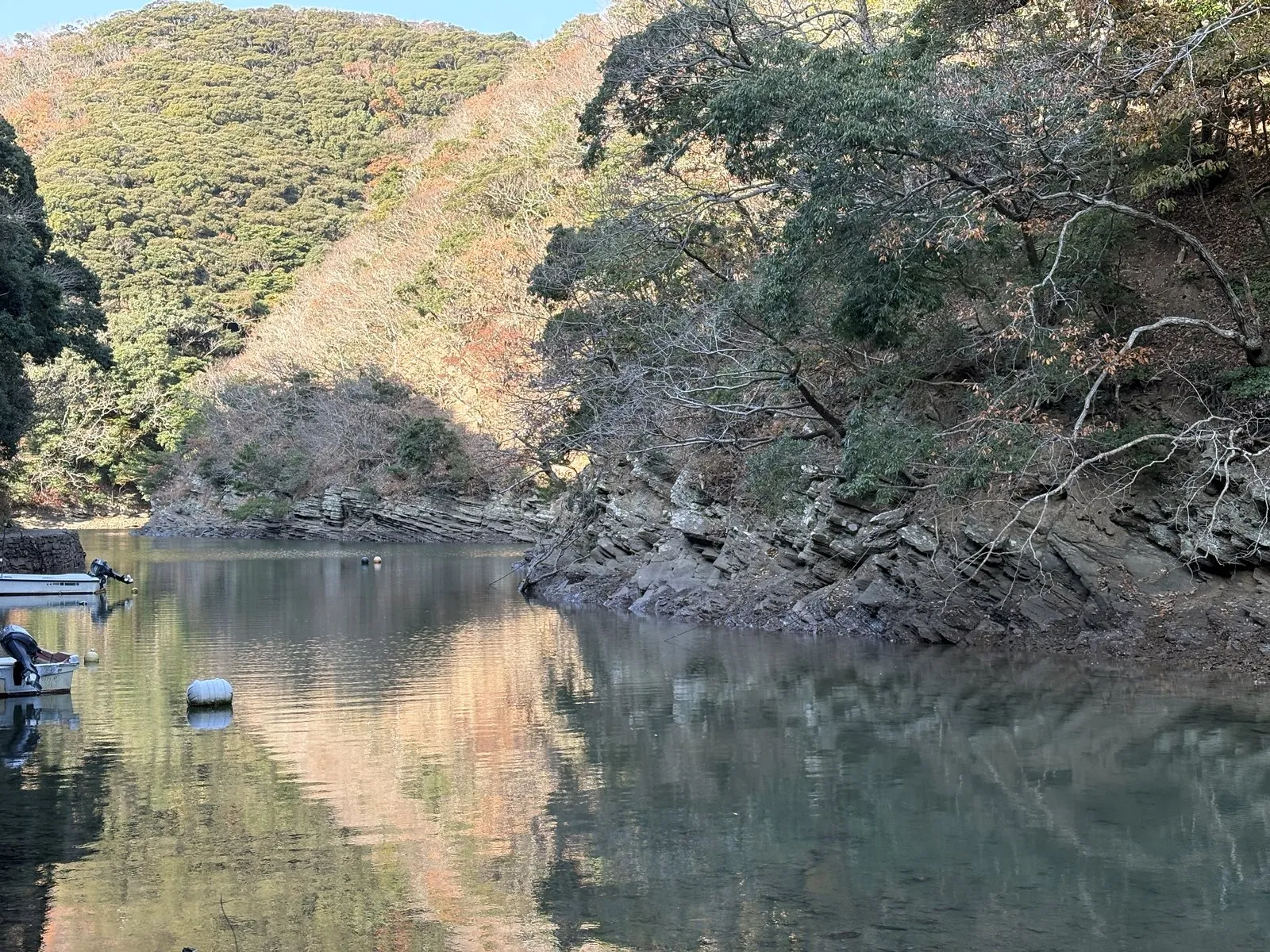
The water was mirror-flat.
The surrounding hills sat reflected in it whole.
The water is so clear that the little boat moored there looked less like it was floating on water than hanging in mid-air.
Among the boats at anchor were squid boats.
Their hulls carry squid-ink stains — a reminder that this is a fishing island too.
| Location | Tsushima City, Nagasaki (Kofunakoshi) |
| Parking | Parking space nearby |
| Don't miss | The horizontally bedded rock wall, and the mirror-still inlet |
| Note | There's a fishing port close by; squid boats are often moored here |
Manzeki Observatory — land stacked in soft green humps
A short drive on from Kofunakoshi is Manzeki Observatory.
The view from here is another good one.
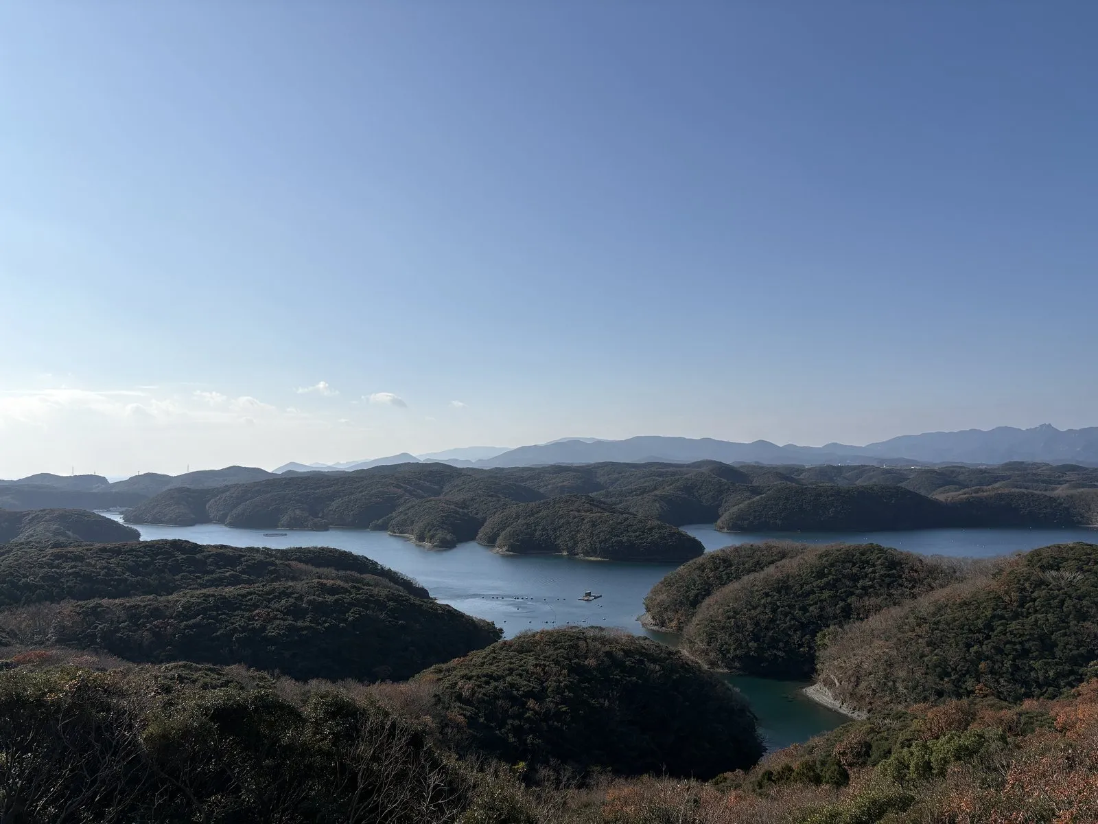
Rounded green peninsulas, layered one behind the next.
The further back they go, the paler they get, so the depth reads clearly.
At Eboshidake I’d looked down on the ria coast from above; here I was seeing it side-on.
Same landform, but change the angle and the impression is completely different.
The shape of the land somehow comes across as endearing, which I didn’t expect.
For what it’s worth, the Manzeki Seto channel that runs beneath the observatory is said to be a waterway cut by hand between the island’s northern and southern halves.
| Location | Tsushima City, Nagasaki (between the northern and southern halves of the island) |
| Parking | Car park near the observatory |
| Don't miss | The tangled bay and the rounded green peninsulas stacked behind each other |
| Note | The Manzeki Seto channel passes below |
Sakanaya En — the fish nobody wanted, and it’s this good
Lunch on day two was at Sakanaya En.
This was the meal on the trip that gave me the most to think about.
I started with the Sosuke menchi-katsu set, ¥1,090.
The croquette is made with isuzumi, a rudderfish.
Isuzumi, I was told, is treated as a pest — it strips the seaweed beds bare.
It has a springy bite and stays moist.
For deep-fried food, there is no greasiness or heaviness to it at all.
Next, a single order of aigo fry, ¥780.
Aigo, rabbitfish, is another of the seaweed-eating problem fish.
No off-flavour, and plenty of savoury depth.
Firmer-fleshed than horse mackerel, and more satisfying to eat.
We added one more dish — Marutoku mackerel sashimi, ¥980.
Farmed by the restaurant’s own operation and landed that morning, apparently.
Deep flavour, springy texture, thick and chewy flesh.
The fish nobody wants and the mackerel landed at dawn are both excellent.
This, I thought, is what eating beside the sea actually means.
| Location | Tsushima City, Nagasaki |
| Specialty | Sosuke menchi-katsu set ¥1,090; aigo fry ¥780; Marutoku mackerel sashimi ¥980 |
| Character | Cooks with the seaweed-eating "pest" fish — isuzumi and aigo |
Ayumodoshi Nature Park — a natural water slide
Fed again, we drove down to the southern end of the island.
Ayumodoshi Nature Park.
We arrived and, once more, a noise escaped me.
Because the river here runs in a thin sheet over one continuous pale slab of rock.
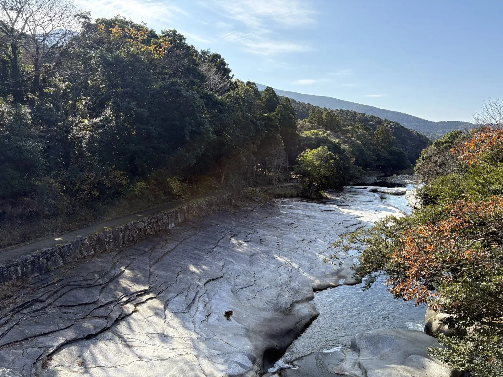
No gravel. No mud.
Bare rock, serving as the riverbed.
A film of water sliding across a smooth stone surface.
It looks exactly like a natural water slide.
Here and there are round hollows scooped into the rock.
Potholes, we decided, peering into them.
In the south of the island, though, granite is said to be present. Granite is thought to form when magma cools slowly deep underground and hardens.
Unlike bedded sedimentary rock, granite has no stacked seams running through it. It is therefore said to be less prone to flaking apart along splits, and more likely to survive as one large continuous slab.
That is thought to be why the riverbed at Ayumodoshi Nature Park is rock itself rather than gravel.
The potholes in the hollows are said to form when pebbles caught in a dip in the rock are spun by the current and grind the rock away over a very long time. Small stones simply turning in the water, and eventually a round hole appears in hard rock. It's a patient business.
Walking on, we came to a point where the character of the rock changed.
Across that boundary, the river changed with it.
Beyond it the flow eased off and the channel widened.
Same river, but change the rock underneath and even the way the water moves changes.
It felt like everything we’d seen over two days on Tsushima, gathered into one small place.
| Location | Tsushima City, Nagasaki (southern part of the island) |
| Parking | Car park in the grounds |
| Don't miss | The river running over a single-slab bed, and the round-scoured potholes |
| Watch out for | Wet rock is extremely slippery. Stay away when the water is high |
Our last stop was the Uchiyama Pass observatory.
Another fine viewpoint.
According to the signage, you can walk the ridgeline from there for a long way.
Next time I come, that’s the path I want to take.
The far-off inlets, and the layers in my hand
One night, two days on Tsushima.
Looking back, I was doing the same thing the entire time.
Look far away. Then look at your feet.
The countless inlets below Eboshidake.
The rounded peninsulas stacked up behind each other at Manzeki.
Both are said to be landforms created when the sea moved into what had been valleys in hill country.
And on the other hand: the dozens of layers piled in the rock face at Unatsura.
The ripple pattern left in the rock at Ajiro.
The mille-feuille wall at Kofunakoshi.
These are thought to be the record of sand and mud settling on the bottom of the sea.
A story about enormous landforms, and a story about a piece of rock that fits in your palm.
The scales couldn’t be more different, and yet in both of them the lead role belongs to the sea.
When that clicked, the island looked slightly different to me.
The food was good, too.
Golden conger you can’t eat anywhere else.
A startlingly good croquette made from fish that used to get thrown away.
A hundred-yen off-cut of kasumaki.
And I won’t forget that boom on the headland in the morning.
We never did see South Korea.
We still don’t know whether the thing in the binoculars was a ship or a building.
But I think that’s fine.
Standing in front of something you can’t explain, saying “what is that?” back and forth — that was the best part of the whole trip.
Geological references: Geological Survey of Japan, AIST ("Geology Map Navi"); Geospatial Information Authority of Japan topographic maps. Statements written as "is said to" or "is thought to" reflect prevailing interpretation rather than settled fact.