Standing at the tip of the Kamogaura headland, I had two seas in front of me.
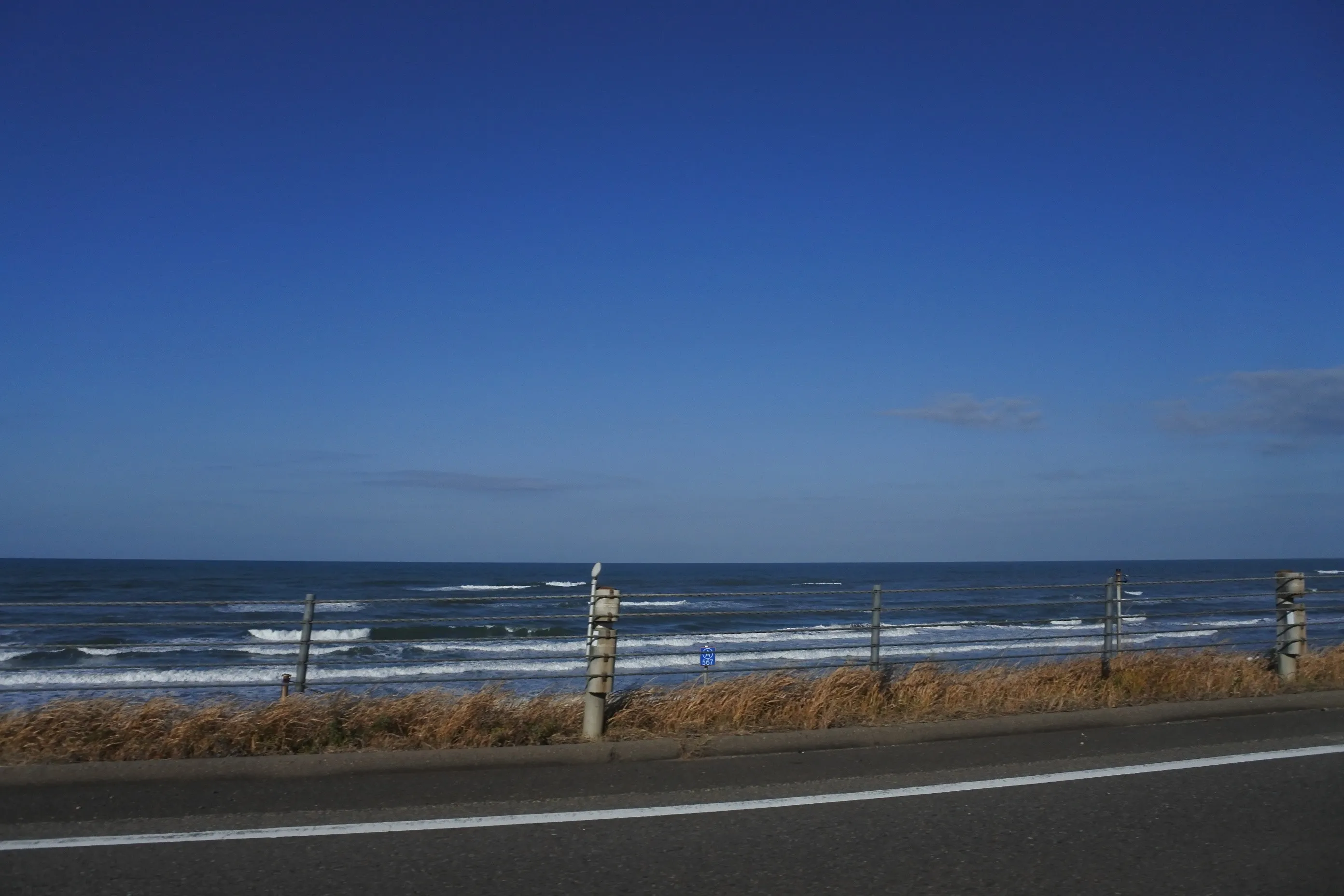
On the outer side, the Sea of Japan was throwing itself against the rocks. Spray hit my face. Step around to the inside of the reef, and the water turned glass-still — clear all the way to the bottom.
The same place. Less than 20 meters apart.
“Why so different?”
The whole day became an answer to that question, written in the shape of the land.
📅 Visited: December 2023
Start with the map — Noto’s two faces
The Noto Peninsula has two coastlines that behave like different countries.
| Sotouura (outer coast) | Uchiura (inner coast) | |
|---|---|---|
| Faces | Northwest, Sea of Japan | East, Nanao Bay |
| Sea | Cliffs, heavy winter swell | Calm bays, sandy beaches |
| Highlights | Senmaida, Kamogaura, Noto Kongō | Wakura Onsen, Tsukumo Bay, Nanao |
Today’s walk took us along the outer coast first — the side that takes the full force of the Sea of Japan.
The inner coast is the opposite character: a quiet harbor town held inside the calm of Nanao Bay.
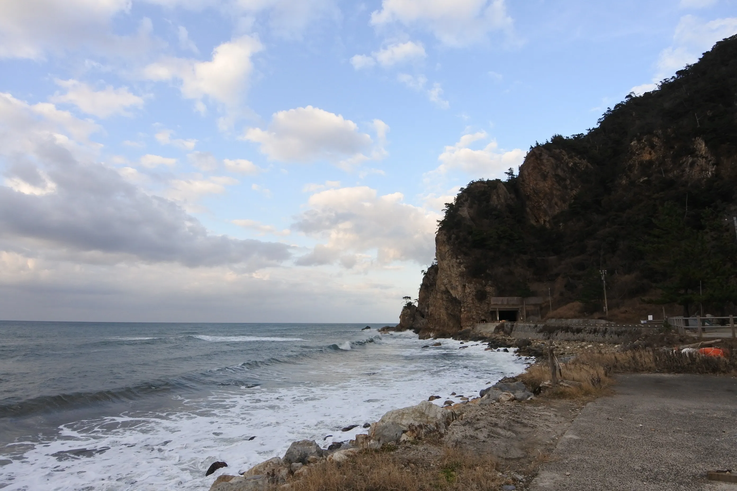
This was a four-person trip — my father and mother, my wife, and me. My father has been a fan of NHK’s Bura Tamori for years and joined the trip with a book on Ishikawa’s geology in one hand. The first stop was Noto Kongō (能登金剛) — a place that takes the outer coast head-on.
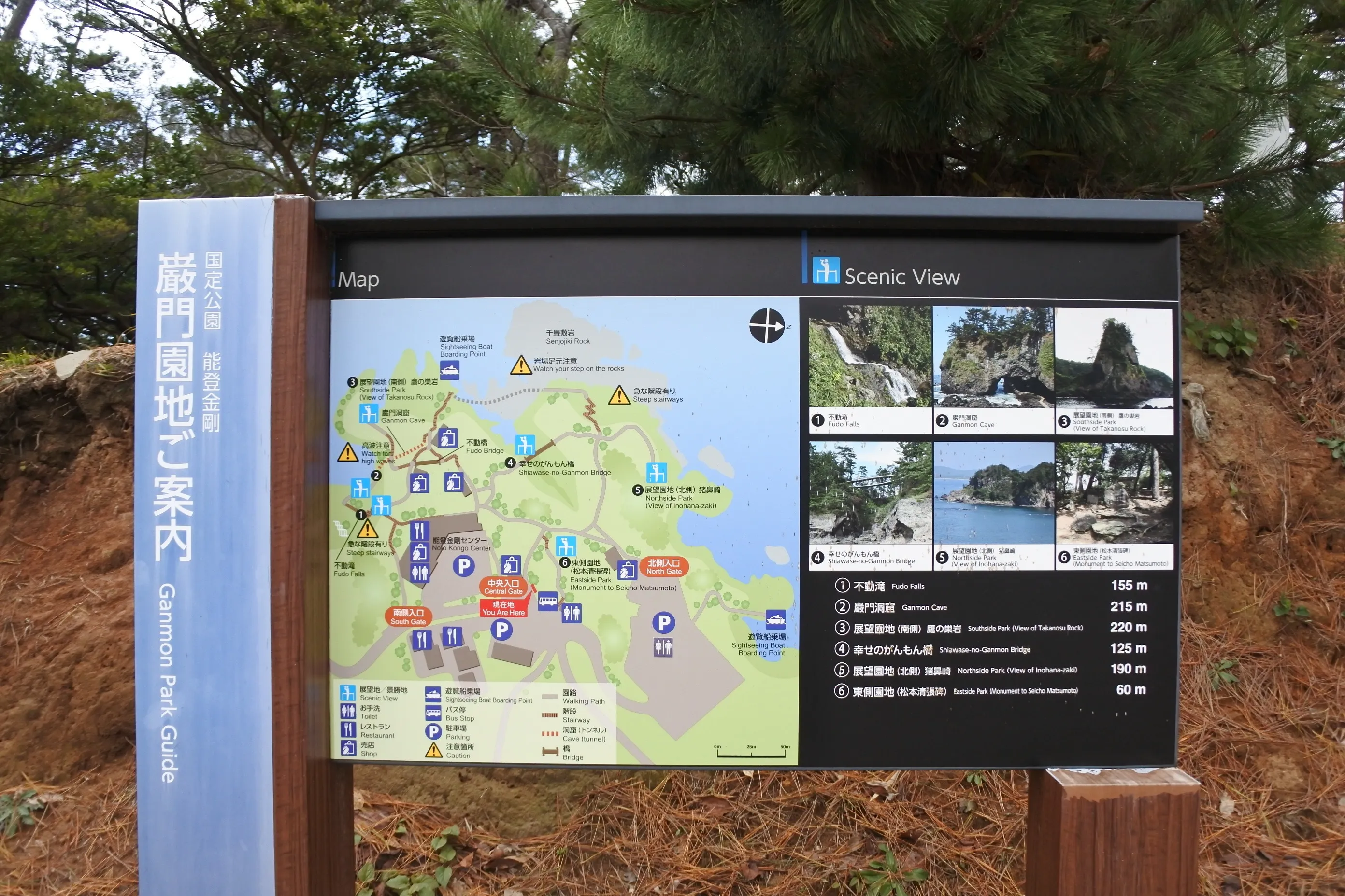
Noto Kongō — a gallery carved by waves
Halfway down the peninsula, on the Shika-machi coast, Noto Kongō (能登金剛) is a stretch of shoreline shaped by relentless wave erosion: stacks, arches, sea caves. A 1.5 km walking path turns the coast into an open-air textbook.
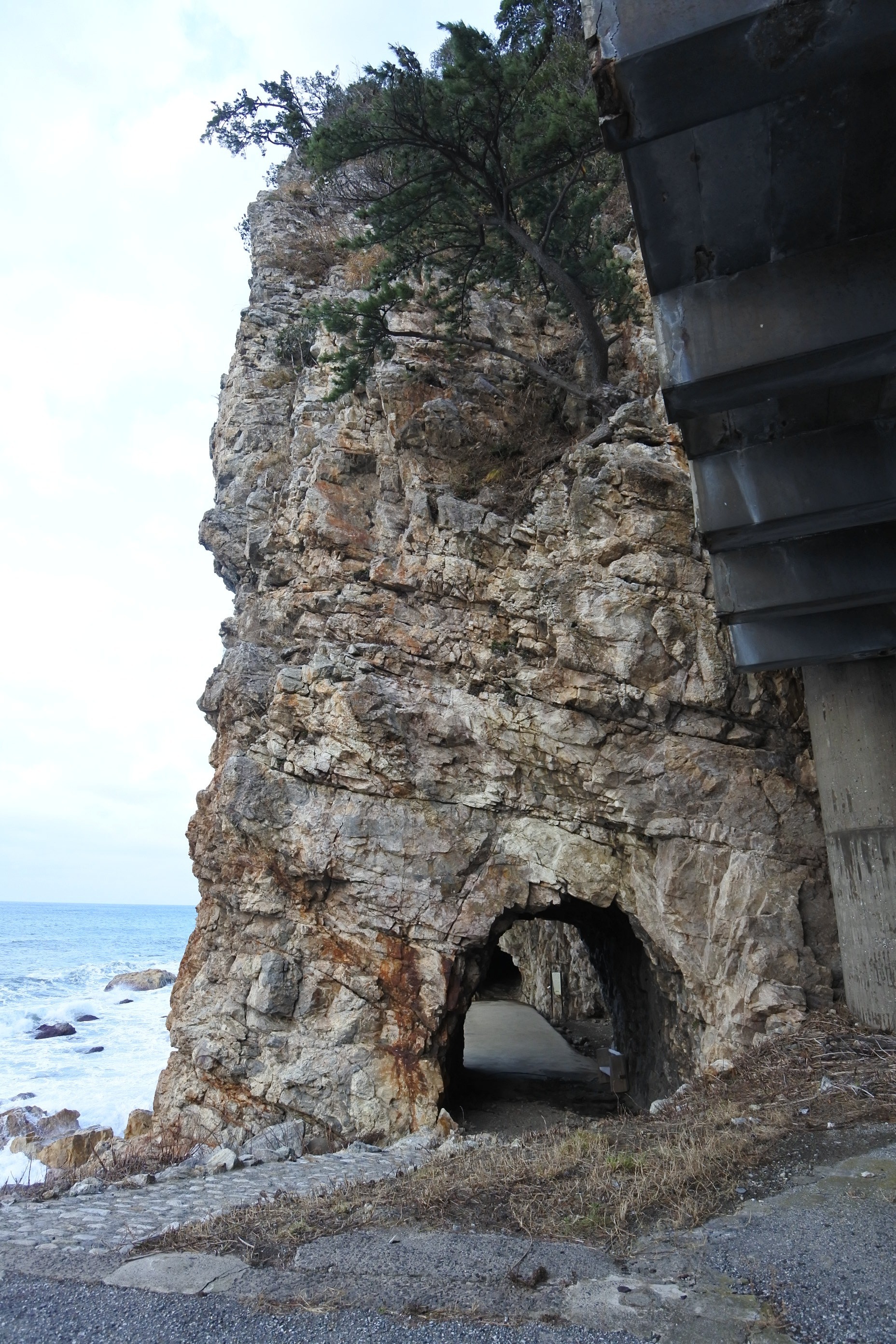
Ganmon — proof that waves drill through stone
Ganmon (巌門) is a natural arch — a tunnel the sea cut clean through the cliff. We arrived close to high tide, and every incoming wave hit the cave with a deep echoing thump. A walkway runs further out, but the swell was high that day, so we turned back partway.
 Click to enlarge
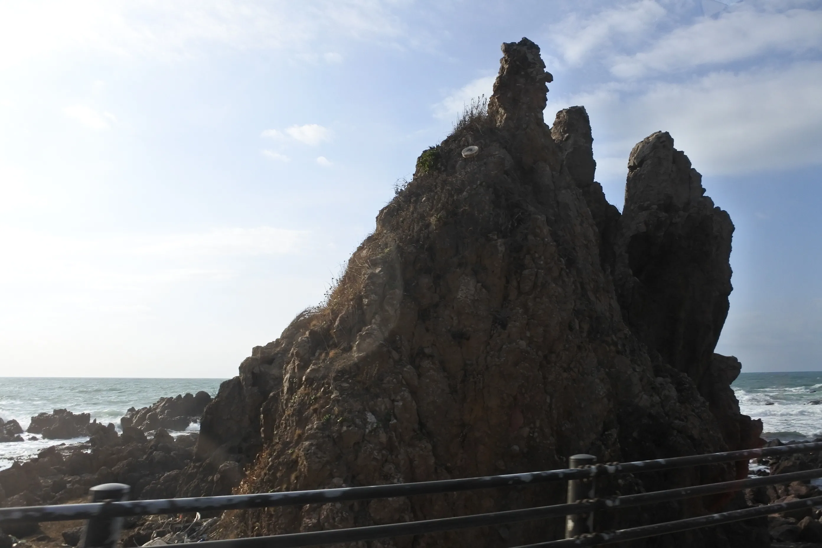
Gunkanjima — the “battleship rock”
Another face of Noto Kongō is Gunkanjima (軍艦島), a rocky islet whose silhouette really does look like a warship — bridge, bow, and all. It’s a survivor: the harder parts of an old headland that the waves couldn’t take down.
Seppun Tunnel — a sliver of sunset between cliffs
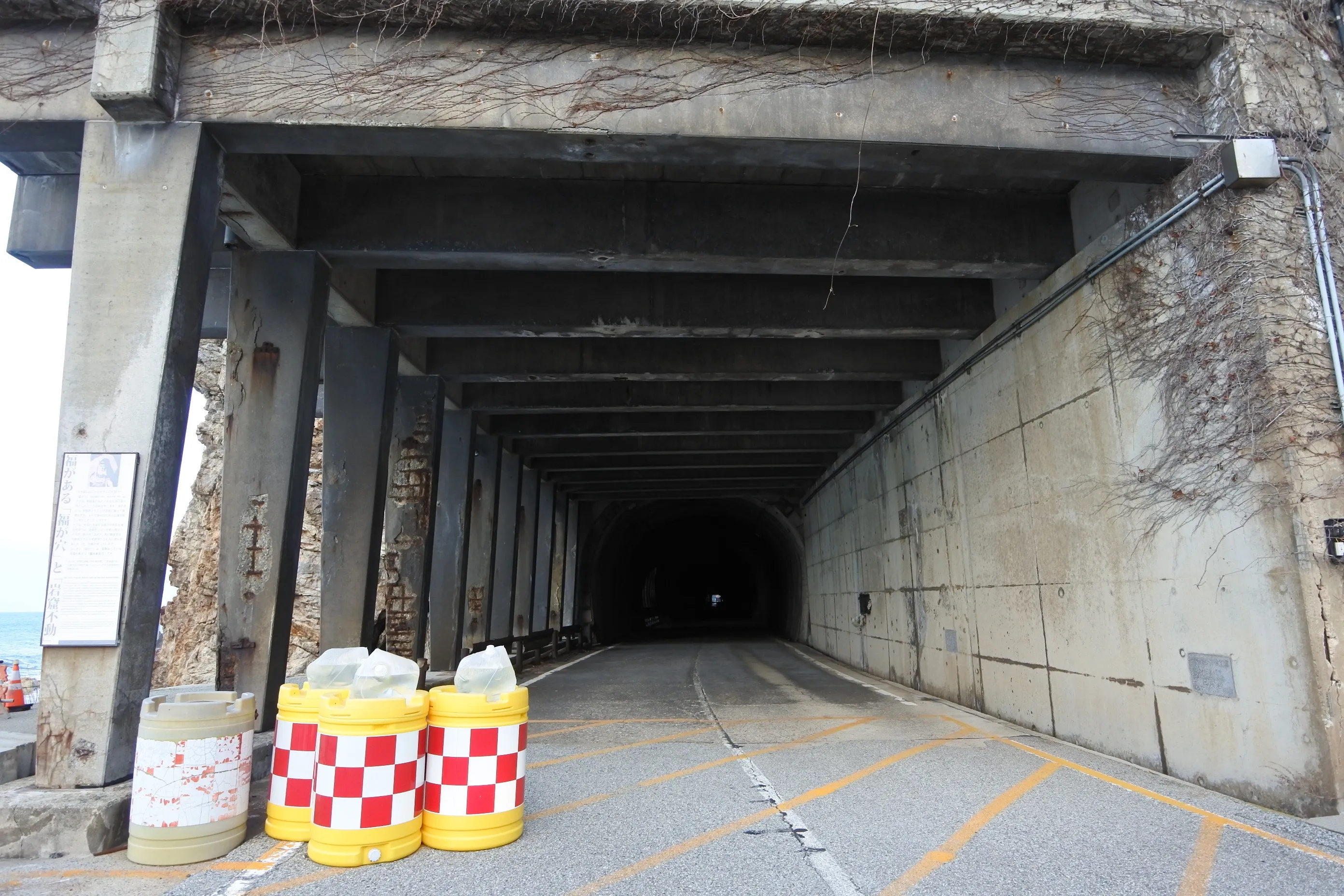
A bit further north along the coast, there’s a hand-cut passage called Seppun Tunnel (接吻トンネル). You can frame the sea and the late-afternoon light through the narrow gap in the rock.
You can apparently walk through it, but it’s an old hand-dug tunnel. With recent earthquake risk in mind, we kept our distance and just took photos.
The same Noto Kongō area also includes Yase Cliff (ヤセの断崖) and Yoshitsune’s Boat Hideaway (義経の舟隠し). Don’t expect drama on the scale of the names, but together they make a quick, varied loop through the outer coast’s geology.
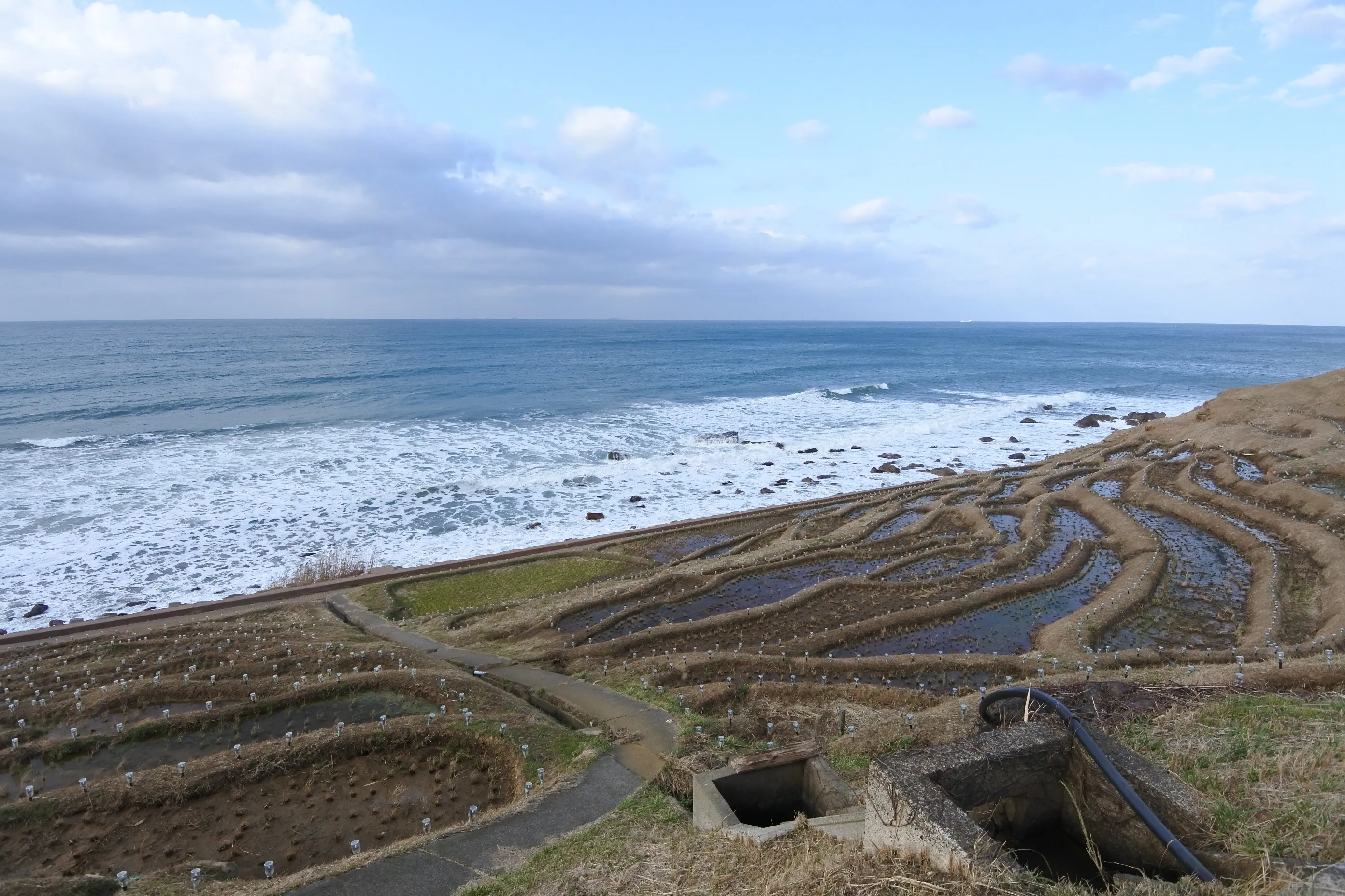
Senmaida — why the rice terraces have to be this steep
Leaving Noto Kongō and pushing further north, we reached one of Noto’s most recognized landscapes: terraced rice paddies stepping down a near-vertical hillside, straight into the Sea of Japan.
This is Shiroyone Senmaida (白米千枚田) — the “Thousand Rice Paddies.”
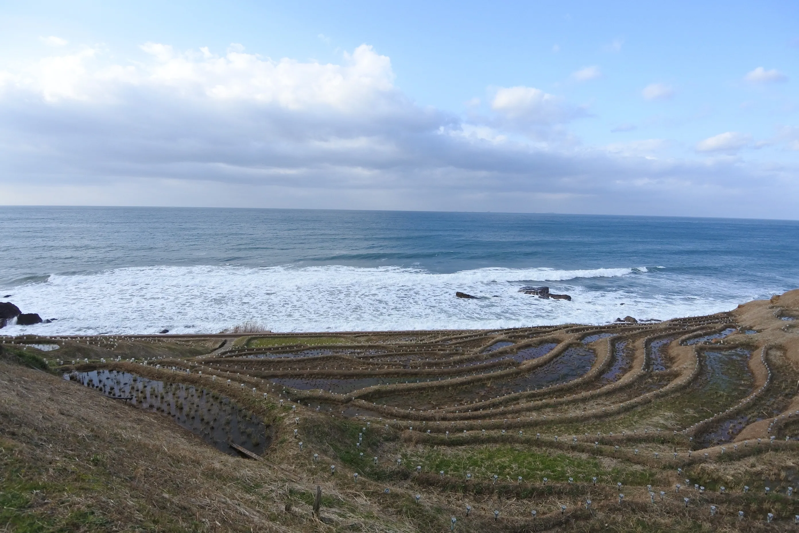

Terraced paddies are what you get when there’s no flat land to farm.
On Noto’s outer coast, the mountains run almost straight into the sea — there’s barely any flat ground in between. That topography is itself the result of Neogene uplift plus relentless erosion by the Sea of Japan: the land was pushed up, then planed back by waves, leaving cliffs and steep slopes right at the shoreline. No flat ground, no big paddies. So farmers built hundreds of small ones, tiered down the hill.
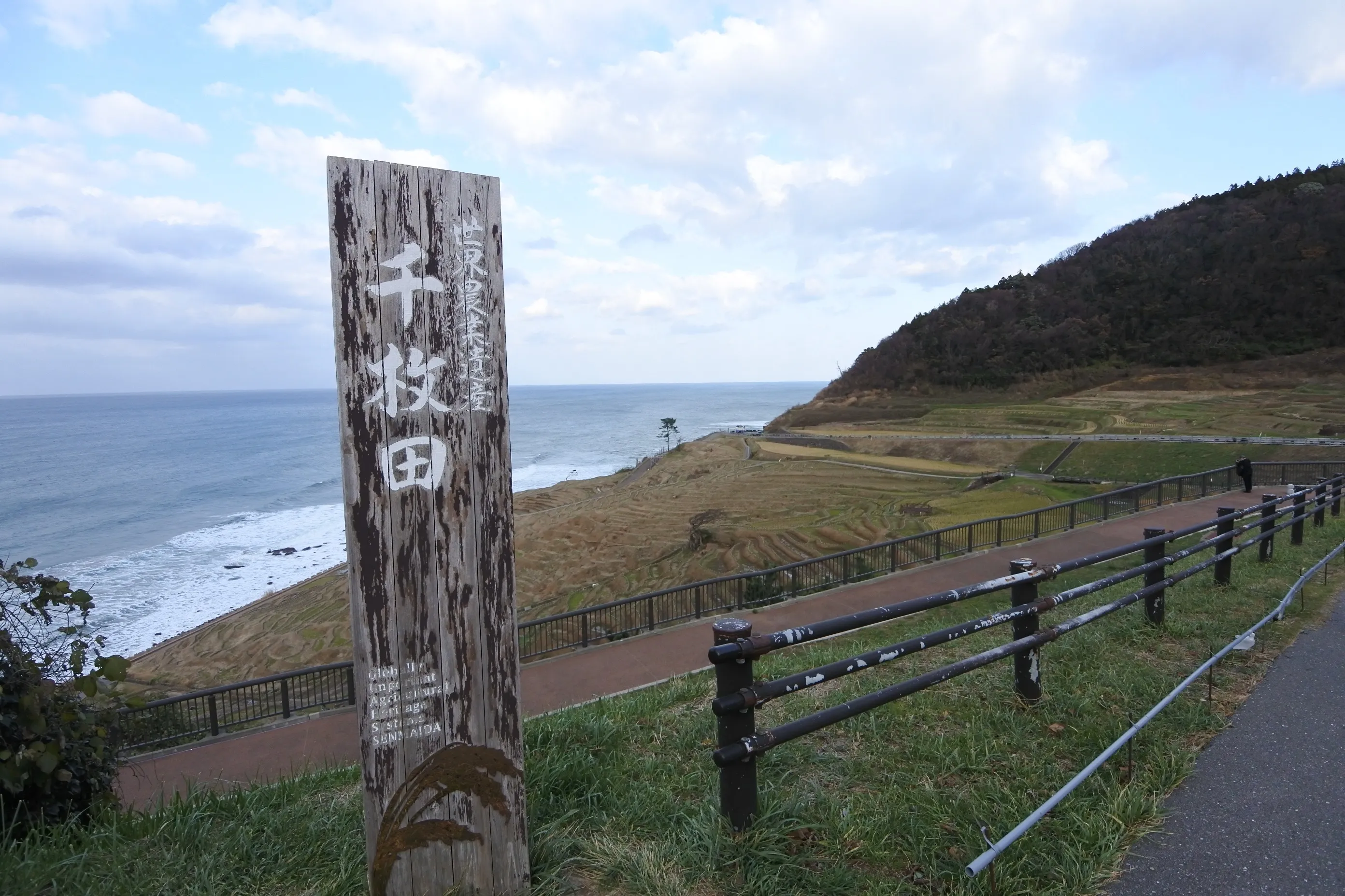
We climbed the stone steps in search of the “second-smallest paddy in the field,” made famous on Bura Tamori. The calves felt it. Worth it anyway.
| Location | Shiroyone, Wajima City, Ishikawa |
| Parking | Roadside station "Senmaida Pocket Park" (free, large lot) |
| Watch out for | Steep stone steps — wear walkable shoes |
| Crowds | Oct–Mar illumination season can mean evening traffic |
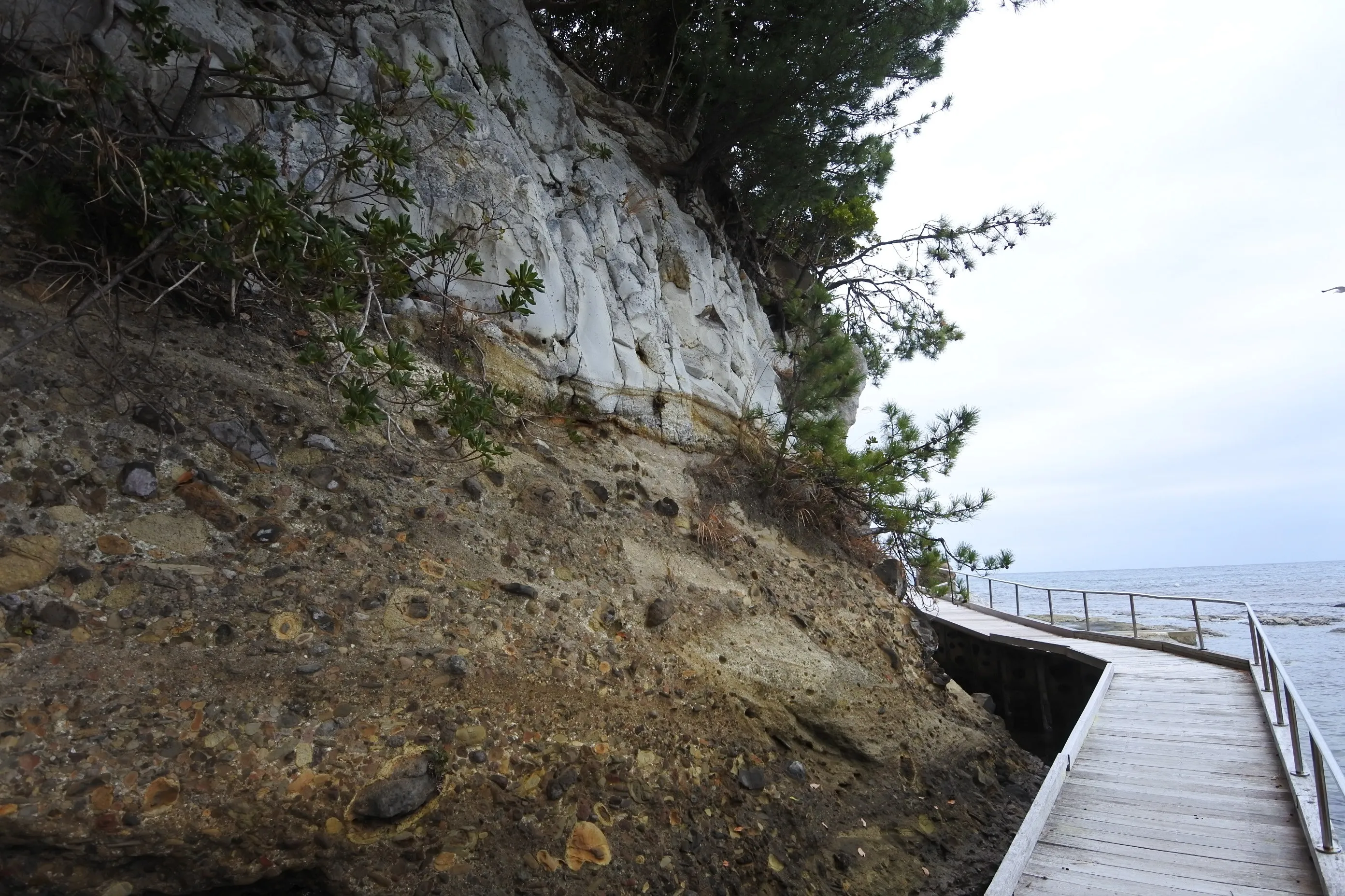
The “two seas,” explained — Kamogaura
A short drive east of Senmaida, and we were back at the question I started with.
Standing at the tip of Kamogaura (鴨ヶ浦), the sea changes dramatically over a 20-meter walk. Why?
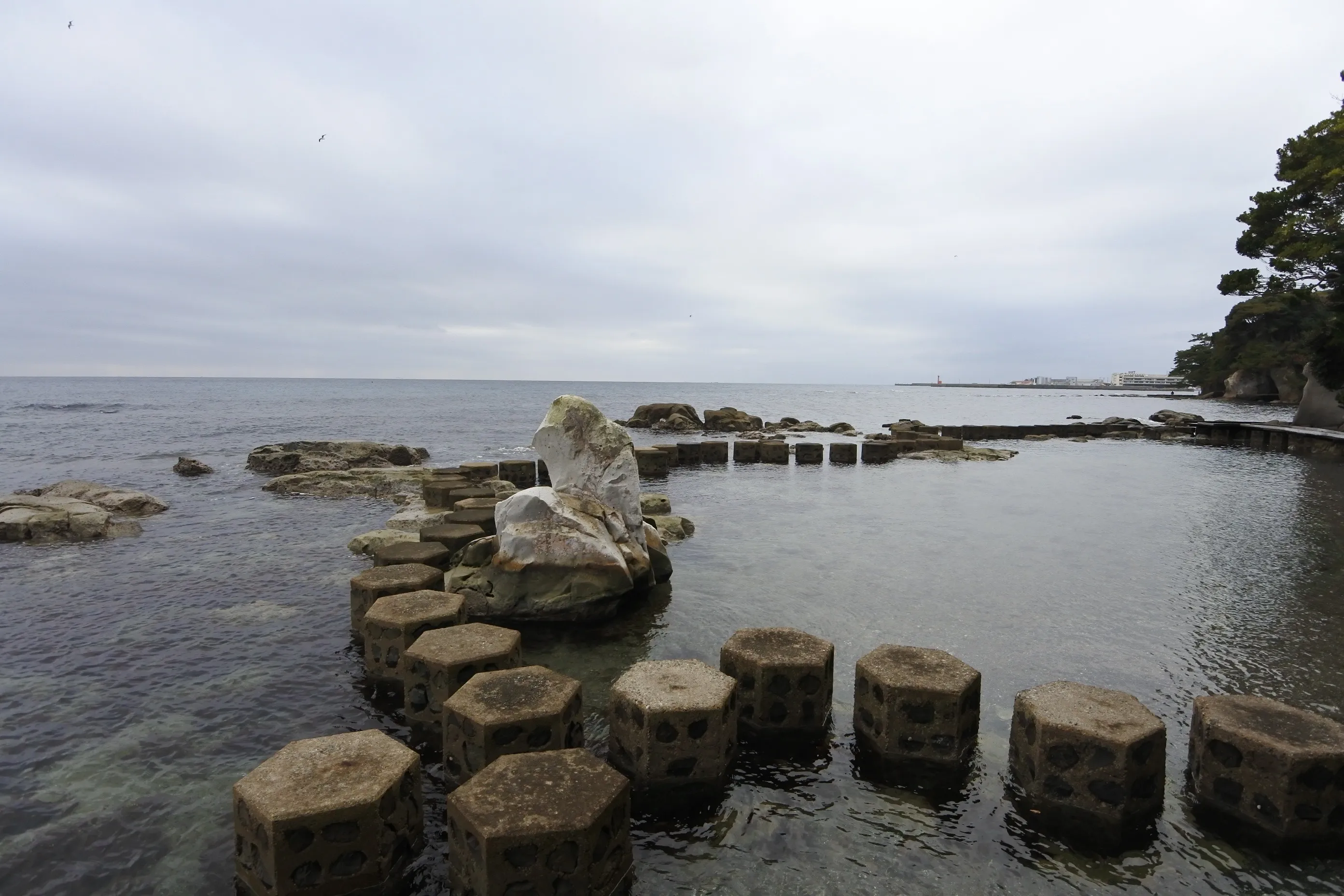
The answer is in the shape of the reef itself. The rock juts out into the open sea and acts as a natural breakwater, taking the brunt of the Sea of Japan’s swell. The inner side sits in its shadow, sheltered from the same waves crashing only meters away.
So you get rough sea and still sea side by side, in the same place.
This is, in miniature, the entire Noto Peninsula. The huge contrast between the outer coast (Sotouura, exposed to the Sea of Japan) and the inner coast (Uchiura, tucked inside Nanao Bay) plays out — at full scale across the peninsula, and at hand scale on this single rocky headland.
Look closely at the rock — there are shells in it
I was walking across the reef when something caught my eye.
The rock surface had unmistakable shapes pressed into it — the ribbed curves of bivalve shells. I touched one. It didn’t move. It wasn’t sitting on the rock; it was the rock.
Fossils.
I would have walked right past them if I hadn’t been watching the ground — the kind of detail you only notice once Bura Tamori has trained your eye. These shells are direct evidence that this rock was once seafloor: clams that lived here millions of years ago, buried in sediment that later became stone.
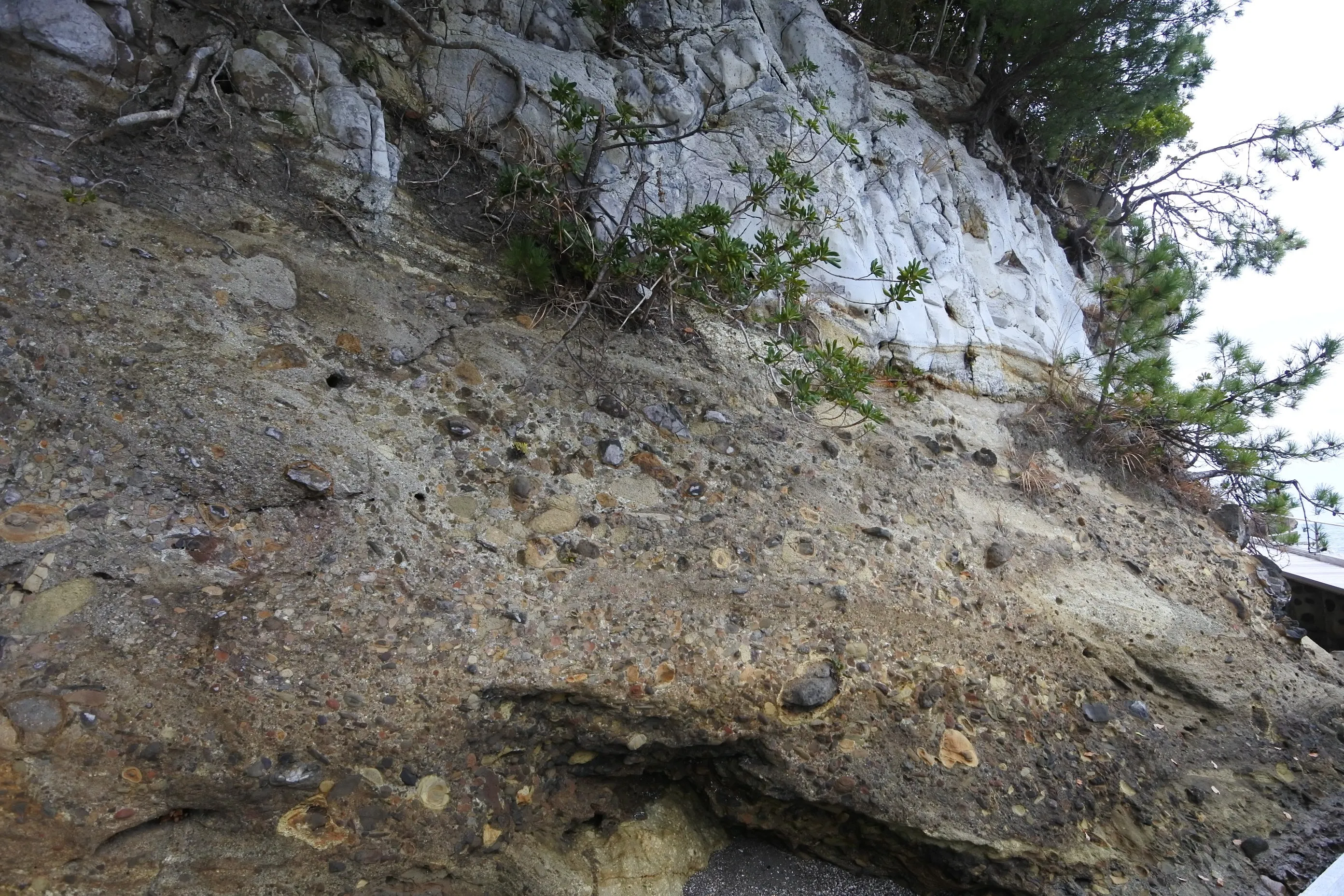
My father stood beside me, taking photo after photo on his phone, muttering “this is incredible” over and over. I was happy to find it. But seeing my father this happy — that doubled it.
| Location | Wajima City, Ishikawa — off National Route 249 |
| Parking | Kamogaura parking lot (free, 10–20 cars) |
| Best at | Low tide — much more of the reef is walkable |
| Watch out for | Slippery rock surfaces — wear grippy shoes |
Dinner that night — Wajimon
We were staying in central Wajima. The original dinner reservation was elsewhere, but with time to spare, we went instead to a small izakaya called Wajimon (わじもん) that my father had spotted from the hotel.
Almost no Google reviews. We walked in half-expecting to gamble on it. By the end of the meal, all four of us were saying the same thing: “tell people about this place.”
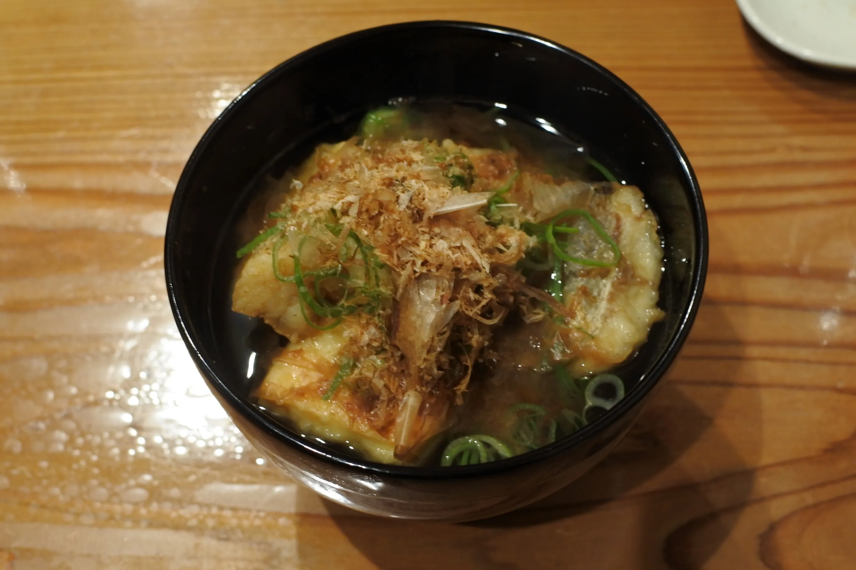
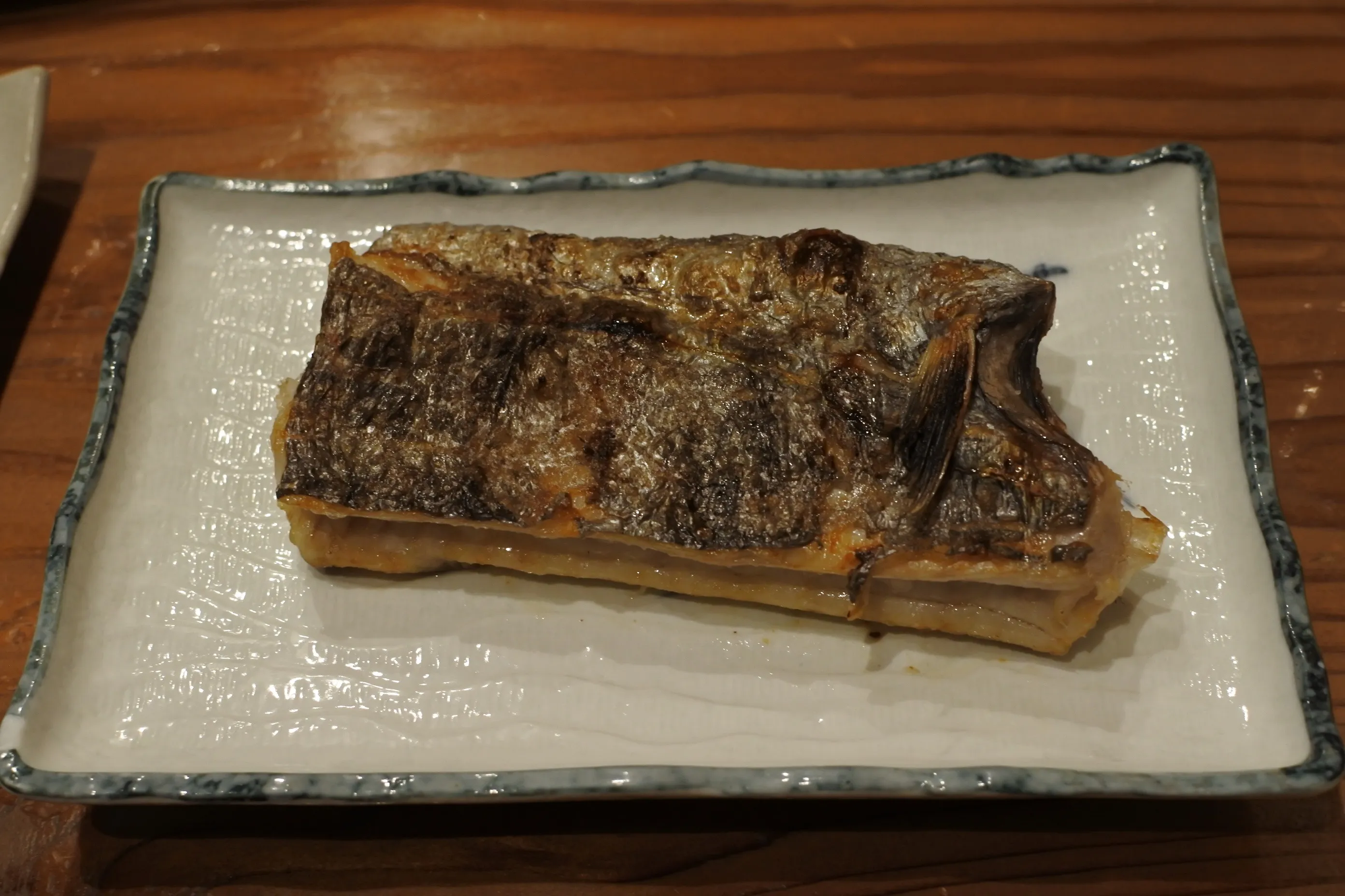
Fugu karaage, seared Noto beef, grilled tachiuo, sashimi of the day — every plate was local, and not one of them missed. At the time of our visit it had no Google reviews at all. A real find.
| Location | Central Wajima City, Ishikawa |
| Parking | Use one of several coin lots in central Wajima |
| Booking | Reservation recommended |
The next morning — Tsukumo Bay, on the inner coast
Before leaving Noto, we made one last stop. The complete opposite of the outer coast: Tsukumo Bay (九十九湾), a mirror-flat sheet of water with intricate inlets folded into the inner coast. A textbook ria coast — exactly the kind of thing a geology fan can’t skip.
…or so I tell it now. Honestly, my father dragged us there.

He was photographing rocks on his phone and pulling up academic papers on the spot. Eyes shining, like a kid. Watching him this happy is its own reason to be on a trip like this.
A trip that lets you talk geology is a trip that’s fun twice.
| Location | Noto-cho, Hōsu District, Ishikawa |
| Parking | Free lot near the walkway entrance |
| Don't miss | A walkway nearly at sea level — the bay is transparent from above |
Geological references: Geological Survey of Japan, AIST ("Geology Map Navi"); Geospatial Information Authority of Japan topographic maps. Statements written as "is thought to" or "is believed to" reflect prevailing interpretation rather than settled fact.